The Price of Residential Land in Large U.S. Cities
Keywords: Home prices, land prices, construction costs, value of residential land, metropolitan areas.
Abstract:
We combine data from several sources to build a database of home values, the replacement cost of housing structures, and residential land values for 46 large metropolitan areas in the U.S. from 1984 to 2004. Our analysis of these new data reveals that appreciation of the value of residential land since the mid-1980s is much more widespread across the country than is commonly believed. We show that, all across the country, the price of residential land has risen faster than construction costs by a wide margin, and that almost all large U.S. metro areas have seen significant increases since 1998. But, we also show that for a majority of large cities, the path of real residential land prices has included some ups and downs since the mid-1980s, rather than having been a steady upward march. All told, we estimate that, over the past two decades, land's share of home value rose by almost 20 percentage points across the range of cities in our sample. Averaging across our sample, by year-end 2004, the value of residential land accounted for about 50 percent of the total market value of housing, up from 32 percent in 1984. An implication of our results is that throughout the country the future course of home prices -- their average rate of appreciation and their volatility -- is likely to be determined even more by the course of land prices than used to be the case.
1 Introduction
In this paper, we extend the methods proposed by Davis and Heathcote (2004) to decompose home values in 46 of the largest U.S. metropolitan areas into the value of housing structures and and the market value of residential land. Thus, this paper introduces new data for studying secular trends and cyclical dynamics of home prices over the period from 1984 through 2004, and emphasizes some new facts about residential land values over the past twenty years that should help in thinking about the future course of home prices around the country.
For us, learning about home prices means studying land prices. This is because housing structures can be easily produced and, thus, should be supplied elastically to the market. So, the replacement cost of any existing housing structure should be tightly linked to the costs of building a similar structure - the costs of building materials and wages in the construction industry. By contrast, the land, location, and amenities associated with an existing home ("land", for short) cannot necessarily be easily reproduced. Land's relatively inelastic supply means that its market value should largely be determined by demand-side factors, such as household incomes, interest rates, or even speculative activity. Moreover, substantial differences in residential land values across metropolitan areas means that land values can, at times, paint a somewhat different picture of pricing dynamics than home values would seem to imply.
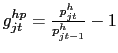
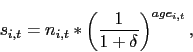
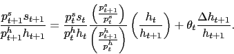
Following Davis and Heathcote (2005), our measurement and analytical framework centers on the idea that the percentage change in home prices in city ![]() during period
during period ![]() (denoted
(denoted ![]() ) equals the weighted average of the percentage change in construction costs
(
) equals the weighted average of the percentage change in construction costs
(![]() ) and the change in residential land prices (
) and the change in residential land prices (![]() ):2
):2
Here, the weight
![]() equals the share of home value accounted for by the market value of residential land at the beginning of the period.
equals the share of home value accounted for by the market value of residential land at the beginning of the period.
We take observations on the percentage change in home prices in major MSAs from Freddie Mac's Conventional Home Price Index (CMHPI), and we obtain construction costs at the city level from data published by R.S. Means Company. To infer the percentage change in land prices, we compute the weights in equation (1) at a benchmark date with estimates based on data on home values and housing characteristics from the Metropolitan American Housing Surveys that are available for 46 large U.S. metropolitan areas ("cities", for short). Given these estimates at the benchmark date, we apply a dynamic equation that is compatible with (1) to derive a full time-series for land's share of home values (back to 1984) based on observed changes in home prices and construction costs in each metro area.
Using these new data, we show that across the wide range of cities in our sample -- along the coasts and across the nation's interior -- land prices have significantly outpaced construction costs since 1984, driving up land's share of home value (![]() ) by an average of almost 20 percentage points over this period. Although we estimate that residential land accounted for less than a quarter of home value in quite a number of large U.S. metro areas twenty years ago, these
days that is true only in Oklahoma City.
) by an average of almost 20 percentage points over this period. Although we estimate that residential land accounted for less than a quarter of home value in quite a number of large U.S. metro areas twenty years ago, these
days that is true only in Oklahoma City.
Another striking result is just how widespread the strength of land prices has been in the current housing boom -- taken to have begun at the end of 1998. We show that in 43 of the 46 large metropolitan areas in our sample, a rapid pace of land price appreciation has pushed up land's share of home value markedly in just the past six years. To be sure, since 1998 land has appreciated at the fastest pace in cities along the East and West coasts, where new residential land was arguably in shortest supply. In these areas -- where in 1998 land already accounted for a large share of home value -- home prices and land prices tell quite a similar story. But, because in 1998 land was not so expensive in places like Houston, Kansas City, Milwaukee, Minneapolis, Pittsburgh, St. Louis, and Tampa, our data on land prices show the significant imprint that has been left by the recent housing boom -- an imprint which is understated to an important extent in data on home prices.
We also emphasize that even though residential land has appreciated significantly, on net, over the past past twenty years, for most large metro areas the path has been more of a roller coaster ride than a steady upward march. Indeed, we show that 39 of the 46 cities in our sample have experienced a clear peak in the real residential land price index, and in many of these cities it has taken 10 years or more for land prices to fully recover from their previous troughs.
Our point estimates for residential land values and their price indexes are derived using several formulas, different sources of data, and a few assumptions about unobserved quantities. However, our main results are rather robust, as they come from interpreting the sizes of changes in Freddie Mac's CMHPI relative to changes in construction costs, measured by data from R.S. Means. Consider, for example, the cases of Minneapolis-St. Paul and San Francisco. Few would disagree that residential land is relatively inexpensive in the former city; our methods estimate land's share of home value in 1984 to have been 0.12 in Minneapolis-St. Paul and 0.75 in San Francisco. Now, suppose that construction costs were flat in real terms in both cities so that equation (1) reduces to
for
To be sure, Minneapolis-St. Paul is an extreme case from our sample, but it may help to clarify that our main results stem from recognizing that in places where land is relatively inexpensive and when land prices are stable, one would expect home prices to move closely with construction costs. And, if one observes home prices outpacing construction costs in places where land has been relatively inexpensive, land must be appreciating at a fairly rapid clip.
The data we bring to bear on these issues is similar to that of Glaeser et al. (2005) and others, but our specific estimation methods differ somewhat from theirs, as do our our points of emphasis and conclusions. For example, Gyourko and Saiz (2004) compare construction costs and home prices around the country, but focus on the distribution of land values within metropolitan areas. A similar emphasis on differences across neighborhoods within MSAs led Glaeser et al. (2004, p. 2) to state that "In the sprawling cities of the American heartland, land remains cheap . . ."
In contrast, we focus on the average value of residential land across an MSA, recognizing that our estimation methods implicitly put relatively greater weight on homes in the more expensive neighborhoods in each MSA. And, although land may be cheap for a sizable fraction of the homes in each large city, we report that, on average, land commands a significant share of home value in most of them. Indeed, as shown in table 6 (toward the end of the paper), by year-end 2004, land accounted for just under half of home value in the median metropolitan area in our sample (Denver). And, even among the bottom quartile of cities in our sample, land's share of home value averaged 29 percent in 2004, up from just 8 percent in 1984. To be sure, land has remained much less expensive across the "heartland" than in cities along the coasts, but over the past two decades -- particularly in the past six years -- it has become much more expensive just about everywhere.
We should note that in this paper we do not take a firm stand on just why land values have soared everywhere, or on whether current or historical valuations look about "right" around the country. Glaeser et al. (2005) and Quigley and Raphael (2005) have argued that zoning restrictions have played a large role in land-price appreciation, at least in some major metro areas. Zoning restrictions would hold down the elasticity of supply of residential land, and thus might explain the surge in the value of land associated with existing homes. Additionally, Campbell et al. (2006) have argued that real interest rates, which have trended down over the past two decades and have been near historic lows in recent years, have also played an important role in stimulating the demand for housing. According with the logic outlined above, we would expect the effects of low interest rates to lead to a particularly rapid appreciation of residential land across the country, although variation in zoning regulations could imply different rates of appreciation in different cities. Further, Davidoff (2005) has argued that the price of land capitalizes the net present value of income opportunities in each metro area, and recent changes to land prices may reflect the extent to which these opportunities have changed. At this point though, we have left to future research an assessment of the quantitative significance of differential zoning regulations, interest rates, or other factors on land valuations across the country.
That said, we emphasize the implication of our data and analysis that, with residential land having appreciated so significantly over the past twenty years around the country, the future course of land prices is expected to play an even more prominent role in governing home prices -- in terms of average appreciation rates and volatility -- in the next two decades.
The next section of the paper is a detailed description of our source data and methods for estimating land's share of home value and generating a constant-quality price index for residential land across large U.S. metropolitan areas. Section 3 reports evidence on the average pace of appreciation and variability of land prices across our sample of metropolitan areas since 1984, with a particular emphasis on the patterns seen in the current housing boom. The final section of the paper discusses the implications of our main empirical results.
2 Data and Methods
In this section, we describe exactly how we merge different sources of data to compute quarterly time-series estimates, for 46 major MSAs in the United States, of (a) the average value of land as a fraction of average home value and (b) the growth rates of residential land prices (constant-quality). For each MSA, the estimation process occurs in 3 steps that are each discussed in detail below.3The complete set of data we create and use (except for the R.S. Means data) are available upon request. For reference, the data labels original to each source (CMHPI, R.S Means, and BEA) are listed in table 1.
2.1 Merging house price, construction cost, and household data
In the first step, we merge MSA-level data from three different sources. We use the MSA-specific Conventional Mortgage House Price Index ("CMHPI"), produced by Freddie Mac, for information on changes of prices of existing homes; MSA-indexes for the growth and level of construction costs as published by R.S. Means (2004); and an estimate of the number of households in each MSA that we create from data from the Bureau of Economic Analysis ("BEA") and the Census Bureau.
Changes in home prices. The CMHPI is a repeat-transactions price index for existing homes published quarterly.4 Changes in this price index provide an estimate of growth in house prices holding quality roughly fixed between two consecutive periods. Appendix A presents evidence that the published level of the MSA-specific CMHPI contains significant measurement error, and describes a state-space model that we use to filter the quarterly CMHPI for each city.5
Changes in construction costs. The book "Square Foot Costs," published by R.S. Means, contains time-series price indexes for residential construction costs for most major cities in every state, with annual observations beginning in 1982.6 Since the published index values refer to "January" of each year, we shift the series slightly and relabel the published index value for January of year ![]() as the index value for the fourth quarter of year
as the index value for the fourth quarter of year ![]() . We generate a quarterly index for each
city by assuming constant quarterly growth rates between years. The indexes can be combined with time-series information (also from R.S. Means) on residential construction costs nationwide to construct dollar costs-per-square-foot for building single-family homes in each city since 1982. As
described below, we merge these square foot construction costs with data from the Metropolitan American Housing Surveys to estimate the value of residential structures in each city.
. We generate a quarterly index for each
city by assuming constant quarterly growth rates between years. The indexes can be combined with time-series information (also from R.S. Means) on residential construction costs nationwide to construct dollar costs-per-square-foot for building single-family homes in each city since 1982. As
described below, we merge these square foot construction costs with data from the Metropolitan American Housing Surveys to estimate the value of residential structures in each city.
Changes in the number of households. We cannot find time-series on the number of households in each MSA, which we use to proxy the pace of construction of new homes (described later). Instead, we create an estimate by dividing annual data on the population in each MSA, published by the BEA, by annual data on aggregate U.S. household size from the Census Bureau. We convert the data to a quarterly basis by assuming that the annual data refers to the second quarter of each year and by assuming constant quarterly growth rates between years.
Our data for household size in the aggregate U.S. comes from Table HH-4, "Households by Size: 1960 to Present," of the Current Population Survey (CPS) Reports.7The BEA population-by-MSA data are available in the Regional Economic Accounts, Local Area Annual Estimates, Table CA1-3, "Personal income and population summary estimates," for Metropolitan Statistical Areas.8The BEA publish population estimates for all CSAs ("Consolidated Statistical Areas"), MSAs, Metropolitan Divisions, and Micropolitan Statistical Areas. For almost all our cities, we use the MSA estimates; for Los Angeles and Anaheim, Dallas and Fort Worth, and San Francisco and Oakland we use the Metropolitan Division data; and for the New York MSA, we add together the New York-White Plains-Wayne and Nassau-Suffolk Metropolitan Divisions.
Of course, the assumption that household size is the same across MSAs is most likely incorrect. However, for our calculations on changes in land prices to be accurate, we only require that the percent change in the number of households is correct, not the actual number of households.
2.2 Creating Benchmark Structures Shares
In the next step of the process, we combine micro data for a few key variables from the Metropolitan American Housing Survey, denoted throughout as AHS-M, with data on construction costs from R.S. Means to estimate a benchmark structures share of house value for each city. The specific MSAs surveyed and dates of the survey that are included in our study are listed in the rightmost column of table 1. For each MSA we use data from the most recent AHS-M, with the exception of New York, Los Angeles, Chicago, Philadelphia, and Detroit. For these cities, we use data from the 1989, 1991, or 1993 AHS-M. For these cities, a specific AHS-M is not collected after 1993, rather the cities are oversampled in the national AHS. We do not use the national AHS because the top-code value for home values has been fixed at $350,000 for some time, and it is therefore quite difficult to reliably calculate average home values in these cities. For example, in the 2003 national AHS more than 40 percent of the observations of owner-occupied single-family detached units in the Los Angeles MSA are top-coded.9
We use the following set of variables from each AHS-M:10
- tenure and nunit2. tenure characterizes the owned/rented/vacant status of the unit. nunit2 specifies whether the structure is single-family detached or attached or in a multiple-unit building. Our sample includes only owner-occupied single-family detached dwellings.
- built, cellar, garage, floors, and unitsf. built records the year the structure was built, cellar whether the unit has a partial or full basement, garage indicates whether the unit has an attached or detached garage, floors the number of floors of the structure, and unitsf is the finished square footage of the structure. We use these variables, along with data from R.S. Means, to compute the new building cost of the structure according to the procedure described later in this section.
- value. value denotes the self-reported market value of the housing unit.
- weight. weight specifies the sampling weight of the unit reported in the AHS-M.
We discard from our sample any housing unit that is missing data for any of these 9 variables. In some cases, built brackets the year in which the house was built, in which case the midpoint of the bracket is chosen. Also, cellar had to be recoded slightly: We specify that a housing unit has a basement if it has a basement under all or part of the building, but not a concrete slab, crawl space, or "something else" under the building. Finally, unitsf and value are top-coded at or around the 97th percentile for each city in each AHS-M. We do not adjust the square-footage of the unit for top-coding but we multiply the top-code of value by 1.5, an adjustment we believe is approximately correct based on results in Davis and Heathcote (2004).
The raw unweighted number of observations that meet all of our criteria are listed in table 2. The median number of observations for each AHS-M sample is just under 1,800, with a minimum sample of about 800 (single-family owner-occupied) for the New York metro area and a maximum of more than 2,500 for Salt Lake City.
For each AHS-M and each housing unit in our sample, we calculate an estimate of the cost of rebuilding the structure if it were brand new as of the AHS-M date. To do this, we start by estimating a regression equation to approximate the cost per square foot of rebuilding any given housing unit in
2003:Q4 for a single-family home in an average U.S. city (denoted by R.S. Means as the "National 30-city average"). The estimated equation, which primarily is meant to account for the nonlinear relationship between building costs per square foot and the size of a residential structure, takes the
form:
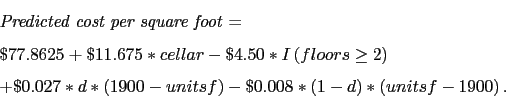
To convert the cost per square foot to a total cost for an average U.S. city at year-end 2003, we multiply the cost-per-square foot from (2) by the reported square footage of the unit and then add $10,000 if the unit has a garage (cost taken from R.S. Means). Finally,
to convert the total cost from an average U.S. city in 2003:4 to the appropriate MSA at the date of the AHS-M survey, we multiply this total cost by
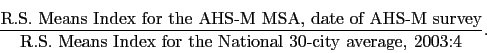 |
(3) |
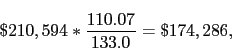
An example might help clarify how these calculations work. Suppose we wish to calculate the cost of a new single-family home to be built new in the Washington DC MSA in 1998:2, and suppose the home is 2,500 square-foot, with two stories, a garage, and a basement. According to (2), the nationwide cost-per-square foot in 2003:4 would be
| (4) |
| (5) |
 |
(6) |
Once we have calculated the cost of building the structure brand new, we depreciate the structure to better estimate its true replacement cost (or market value of the structure). The way to think about depreciation in this context is that it measures the expense required to bring an existing
aged structure up to "like-new" standards. This includes expenditures on physical repairs, such as fixing a roof, as well as expenditures on functional improvements, such as improving the insulation. In our calculations, the depreciation on a structure is simply a function of its age. Let
![]() refer to the new building cost of the structure associated with household
refer to the new building cost of the structure associated with household ![]() in period
in period ![]() and
and ![]() refer to the replacement cost of the structure after
accounting for depreciation. We calculate
refer to the replacement cost of the structure after
accounting for depreciation. We calculate
 |
(7) |
Our final step with the AHS-M data, we calculate a benchmark MSA-wide average structures share for the period corresponding to the AHS-M survey date, denoted
![]() , as in period
, as in period ![]() , as
, as
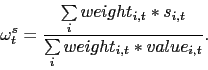 |
(8) |
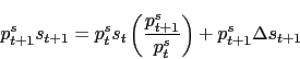
2.3 Extrapolating Benchmark Structures Shares
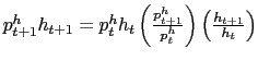
In the final step of our procedure, we extrapolate our benchmark structures share for each MSA to uncover a quarterly time-series of structures shares. First, remember that we consider the total value of housing in any MSA in any period ![]() , denoted as
, denoted as ![]() , as the sum of the replacement cost of structures in that MSA,
, as the sum of the replacement cost of structures in that MSA, ![]() , and the market value of the land in that MSA,
, and the market value of the land in that MSA, ![]() , that is,
, that is,
where
Now, assume that the nominal value of net new structures in an MSA is equal to some proportion, call it ![]() , of the nominal value of net new housing value in that MSA, denoted
, of the nominal value of net new housing value in that MSA, denoted
![]() ,
,
To finish, divide both sides of (12) by the nominal value of housing at ![]() ,
,
![]() :
:
 when dividing
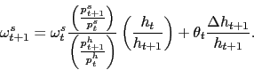
Define the total structures share of aggregate house value in an MSA in period ![]() as
as
![]() . By definition -- see equation (9) -- this equals
. By definition -- see equation (9) -- this equals
![]() from equation (1). Substituting this into (13) yields
from equation (1). Substituting this into (13) yields
Notice the implications of equation (14). First, in the absence of growth in the housing stock, i.e. ![]() , the structures share in
, the structures share in ![]() simply equals the structures share in
simply equals the structures share in ![]() , adjusted for growth in construction costs relative to
house prices. In growing cities, that is,
, adjusted for growth in construction costs relative to
house prices. In growing cities, that is, ![]() , the growth of construction costs relative to existing home prices matters less in determining the structures share next period.
Instead, the share of new homes accounted for by structures plays a role, since new homes account for a nonzero fraction of the total stock next period.
, the growth of construction costs relative to existing home prices matters less in determining the structures share next period.
Instead, the share of new homes accounted for by structures plays a role, since new homes account for a nonzero fraction of the total stock next period.
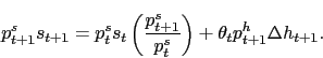
To implement this equation for each MSA, we start by benchmarking the structures share at the appropriate date to our estimate of the structures share derived from AHS-M data that was detailed earlier. To update this benchmark share -- that is, to produce a continuous quarterly time series of
the structures share from 1984:4 through 2004:4 according to equation (14)- we use MSA-level construction cost indexes from R.S. Means and the corrected CMHPI for
![]() and
and
![]() , respectively.14
, respectively.14
To complete the updating, we make two more assumptions. First, we assume that
![]() is proportional to growth in the number of households in an MSA. This assumption is consistent with the Davis and Heathcote (2004) data on the real stock of housing
and data from the Census Bureau on the number of households in the U.S.15Second, we assume that the fraction of new home value accounted for by the
structure is
is proportional to growth in the number of households in an MSA. This assumption is consistent with the Davis and Heathcote (2004) data on the real stock of housing
and data from the Census Bureau on the number of households in the U.S.15Second, we assume that the fraction of new home value accounted for by the
structure is
 |
(15) |
and for Newly Built Homes (
|
(0,0)(1,0)1
For a few midwestern cities early in the sample period, our algorithm implies near-zero point estimates for land's average share of home value; we set land's share to 0.05 in these few cases.
Finally, we use a transformation of equation (1) to compute percent changes for a (constant-quality) index of residential land prices:
![\begin{displaymath} g_{jt}^{lp} = \frac{1}{\omega_{jt-1}^l} [g_{jt}^{hp} - (1 - \omega_{jt-1}^l) g_{jt}^{cc}] . \end{displaymath}](img68.gif)
3 Results
The algorithm of the previous section results in a database of quarterly observations on the components of home values from 1984 through 2004 for 46 large U.S. metropolitan areas. More specifically, we have estimated average values for the stock of single-family, owner-occupied homes and their structure and land components, and we have constructed price indexes for residential land, as well.17 In this section, we describe the basic trends uncovered by these new data, focusing on 5 broad geographic regions -- cities in the Midwest, Southeast, Southwest, and along the East and West coasts.18The data show some variation across cities within these regions, but the regional variation is predominant. We describe changes in the components of home value from 1984 through 1998, then focus on the housing boom that has affected most of the country since 1998. After documenting the trends in land values since 1984, we show that most cities across the country have experienced a significant land pricing-cycle since the mid-1980s, in which the real price of residential land reached a significant peak followed by a long period of recovery. In large cities in the southwest, the peak occurred around 1985 -- essentially following a boom in energy production in that region; in other cities, the peaks were around 1990. Only for a handful of large midwest cities have real residential land prices exhibited a fairly steady upward march over the past two decades.
3.1 Components of home value in 1984
Table A shows that in the mid-1980s homes were, on average, much less expensive in large U.S. cities in the Midwest and the Southeast than along the East and West coasts. The regions differed little in terms of their average replacement cost of residential structures, but there were large regional differences in the value of residential land. In 2004 dollars, the average residential lot in 1984 was worth just $14,000 in the Midwest, $135,000 along the West Coast, and $62,000 across our entire sample of large cities.19As of year-end 1984, on average, residential land accounted for just 11 percent of home value in cities in the Midwest, 55 percent of value in cities along the West Coast, and 32 percent of value across our full sample.
| Region | Home value ($1000s) |
Structure value ($1000s) |
Land value ($1000s) |
Memo: Land's share of value (percent) |
|---|---|---|---|---|
| a. Midwest | 120 | 106 | 14 | 11 |
| b. Southeast | 129 | 94 | 36 | 27 |
| c. Southwest | 158 | 100 | 58 | 35 |
| d. East Coast | 172 | 105 | 67 | 38 |
| e. West Coast | 226 | 91 | 135 | 55 |
| f. Full sample | 162 | 100 | 62 | 32 |
2004 dollars. Unweighted averages across sample-cities in each region.
Components may not sum to totals due to rounding.
3.2 Changes in home value, 1984 through 1998
The following table B documents the cumulative changes in the components of home value between 1984 and 1998 in the 5 geographic regions. In real terms -- that is, relative to the core PCE price index -- homes became considerably more valuable in 4 of the 5 regions -- the exception being in cities in the Southwest.20 In real terms, average home values in the Southwest and the share of home value accounted for by the market value of residential land was lower in 1998 than in 1984. By contrast, the two other regions of the country that had relatively low home values in 1984 -- the Midwest and the Southeast -- experienced significant increases, on net, over the next 15 years, and the lion's share of those increases can be traced to very fast appreciation of residential land. Indeed, as reported in the table, land's share of home values rose by 16 percentage points and 9 percentage points, respectively, in Midwest and Southeast cities from 1984 through 1998. Appreciating land values also pushed up home values, in real terms, in cities along the East and West coasts, but the average increases in land's share of home value -- 3 and 6 percentage points, respectively, over this period -- were not as large as in the Midwest and Southeast. Looking across all the large cities in our sample, the real value of average residential lots increased 50 percent from 1984 through 1998, and land's share of home value increased 8 percentage points, from 32 percent to 40 percent.
| Region | Cumulative change in: Home value (pct) |
Cumulative change in: Structure value (pct) |
Cumulative change in: Land value (pct) |
Change in land's share of value (pctg pts) |
|---|---|---|---|---|
| a. Midwest | 26 | 2 | 208 | 16 |
| b. Southeast | 14 | 0 | 53 | 9 |
| c. Southwest | -9 | -4 | -17 | -4 |
| d. East Coast | 24 | 8 | 49 | 3 |
| e. West Coast | 39 | 20 | 51 | 6 |
| f. Full sample | 22 | 5 | 48 | 8 |
In real terms; unweighted averages across sample-cities in each region.
3.3 Changes in home value, 1999 through 2004
Table C indicates how widespread across the country the recent housing boom has been. All 5 regions have seen substantial real increases in average home values since 1998 -- about 25 percent (cumulatively) in large cities in the Midwest, Southeast, and Southwest, and around 80 percent along the East and West coasts. In addition, although construction costs around the country have generally outpaced consumer price inflation -- leading to increases in the real value of residential structures on the order of 10 to 18 percent since 1998 -- the more important story has been a widespread rapid appreciation of residential land. We estimate increases in the market value of residential lots around 50 percent in the Southeast and Southwest, 75 percent in the Midwest, and around 125 percent along the East and West coasts. Thus, land's share of home value has risen considerably in each of the 5 regions of the country, up 7 to 10 percentage points in the South and Midwest and 13 or 18 percentage points along the coasts.
Indeed, among the 46 large cities in our sample, only Charlotte and Salt Lake City show lower land shares of home value in 2004 than in 1998, and Memphis's share only edged up by 1 percentage point. Since 1998, the largest increases in land's share of home value were registered in Providence, RI (26 percentage points), New York City (23), Minneapolis/St. Paul (21), St. Louis (18), and Washington, DC (18). In St. Louis, land's 30 percent share of home value was still well below our sample-average (51 percent), but was appreciably greater than the 12 percent share recorded just six years earlier. Since 1998, home values in St. Louis rose 34 percent in real terms -- well below the sample-average pace -- but the relatively low value of residential lots in 1998 led this to translate into more than a 200 percent cumulative increase in the real value of residential land -- right up there with the other fastest increases in our sample (Sacramento and San Bernardino, CA, and Providence, RI).
| Region | Cumulative change in: Home value (pct) |
Cumulative change in: Structure value (pct) |
Cumulative change in: Land value (pct) |
Change in land's share of value (pctg pts) |
|---|---|---|---|---|
| a. Midwest | 28 | 9 | 75 | 10 |
| b. Southeast | 26 | 15 | 45 | 7 |
| c. Southwest | 24 | 10 | 52 | 8 |
| d. East Coast | 77 | 14 | 115 | 18 |
| e. West Coast | 81 | 18 | 145 | 13 |
| f. Full sample | 56 | 13 | 105 | 11 |
In real terms; unweighted averages across sample-cities in each region.
3.4 Components of home value in 2004
As can be seen in table D, by year-end 2004, single-family owner-occupied homes remained much more expensive in cities along the East and West coasts ($376,000 and $568,000, respectively) than in the other regions of the country, where the average was near $185,000. Our estimates of the value of residential structures for homes along the coasts were not much greater than those for the other 3 regions, so that nearly all of the difference in home values reflected differences in the value of their land components. The average lot was worth about $75,000 in cities in the Midwest, Southeast, and Southwest, but was valued at $245,000 on the East Coast, and $440,000 in West Coast cities. At year-end 2004, we estimate that land's share of home value had risen to 75 percent along the West Coast, 65 percent on the East Coast, compared with about 40 percent in the other 3 regions and 51 percent across the entire sample of 46 cities.
Still, despite the wider differences in home values across the country in 2004, we find that 4 of the 5 regions saw substantial increases in land values and land shares since 1984. Midwest cities saw their share rise to 36 percent from just 11 percent twenty years earlier -- the largest percentage-point increase of the 5 regions -- and these cities saw the largest cumulative increase in average land values as well, averaging more than a four-fold increase over the twenty-year period. On net, the slowest average rates of increase in home and land values were found for cities in the Southwest, and, by our estimates, there were several cities in that region for which average home values in 2004 remained below their 1984 levels (in real terms) -- Dallas, Fort Worth, Houston, Houston, Oklahoma City, and San Antonio. Overall, though, we estimate that, on average, real land values rose 26 percent since 1984 in our Southwest cities, and land's share of home value edged up 4 percentage points, on net, to 38 percent at year-end 2004.21
| Region | Home value ($1000s) |
Structure value ($1000s) |
Land value ($1000s) |
Land's share of value (percent) |
Memo: Land's share in 1984 (percent) |
| a. Midwest | 192 | 119 | 73 | 36 | 11 |
| b. Southeast | 187 | 108 | 79 | 42 | 27 |
| c. Southwest | 179 | 106 | 73 | 38 | 35 |
| d. East Coast | 376 | 131 | 245 | 64 | 38 |
| e. West Coast | 568 | 128 | 440 | 74 | 55 |
| f. Full sample | 307 | 120 | 187 | 51 | 32 |
Unweighted averages across sample-cities in each region.
3.5 Changes in the distribution of land's share of home value, 1984 through 2004
The widespread net increase in land's share of home value across the U.S. since the mid-1980s is evident in figure 2, which shows the cumulative distribution function of land's share of home value across the 46 large cities in our sample as of year-end 1984, 1998, and 2004. As was consistent with the relatively fast appreciation of real land values in the Midwest and Southeast from 1984 through 1998, figure 2 shows a relatively large rightward shift in the distribution of land share for cities in the lower two-thirds of the distribution. By contrast, for cities with the largest land shares, the line segment in 1998 lies just about on top of the 1984-segment, indicating that cities shuffled their order at the top of the distribution in that period; but, overall, there was not a material net increase in land's share in the most expensive cities. Between 1998 and 2004, the entire distribution function for land's share of home value shifted noticeably to the right, with somewhat larger increases generally occurring among cities in the top half of the distribution. At year-end 2004, the average share of home value we attribute to residential land ranged from a low of about 25 percent in Oklahoma City to nearly 90 percent in San Francisco. The range from lowest to highest is about the same as in 1984, as land's share of home value was less than 5 percent in a handful of cities in the middle of the country -- running from Buffalo down to Pittsburgh and over to St. Louis, for example -- and reached about 75 percent in San Francisco and Anaheim.
across Metropolitan Areas in Selected Years
(0,0)(1,0)1
3.6 Changes in the distribution of residential land values, 1984 through 2004
Figure 3 shows how far the distribution of average real land values shifted between 1984 and 1998, and then again over the past six years. Consistent with the patterns evident in figure 2, real land values in cities in the lower half of the distribution can be seen to have shifted by proportionately more from 1984 to 1998 (note the log scale for the x-axis). Although the entire distribution shifted further to the right between 1998 and 2004, in recent years the disproportionate increases in real land values occurred in cities in the top half of the distribution.
across Metropolitan Areas in Selected Years
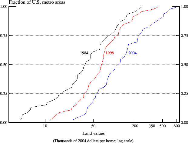
(0,0)(1,0)1
3.7 Volatility of real land prices since 1984
The previous subsections have emphasized net changes in the components of home value, in real terms, over a rather long period of time -- 1984 through 1998 -- and in the current housing boom -- 1999 through 2004. In the course of that discussion, we mentioned that real land and home values in large cities in the Southwest have taken quite a roller coaster ride, and it was not until the early 2000s that many of those cities saw their average real home values return to levels last registered in the mid-1980s! This subsection emphasizes that the majority of large cities in other regions of the country has also experienced significant and prolonged decline in real land prices -- generally in the latter 1980s or early 1990s, when national indexes of existing home prices fell in real terms.
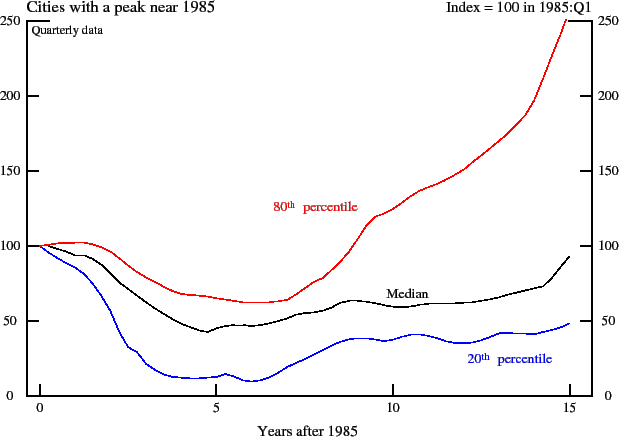
Real land prices in the Southwest after 1985. Figure 4 plots indexes of real land prices across 9 cities in the southwestern U.S. that experienced a peak near early-1985. The indexes are normalized so that their value in 1985:Q1 is 100, and separate indexes are shown for
the median city in each quarter after 1985:Q1 (the black line) and for the cities representing the 20th and 80th percentiles of the distribution (the blue and red lines).22
According to figure 4, the median city in this group -- Houston -- saw its land price index fall 50 percent, cumulatively, in real terms, over the five years ended in 1989. Although real land prices in Houston began rising gradually in 1990, our estimates imply that the index did not fully return
to its early-1985 level until 1999 -- 15 years later! Denver's experience is reflected in the red line: There, real land prices fell, cumulatively, by 60 percent from 1985 through 1991; however, the recovery in that city was much sharper, and by the mid-1990s Denver's index of real land prices had
returned to its 1985-level. By 1999 (the last period shown in figure 4), the index of real land prices was two-and-a-half times as high as it had been 15 years earlier. By contrast, San Antonio -- whose experience is reflected in the blue line -- saw a remarkably large drop in real land prices, and
by 1999 the level of the index in that city had recovered only about halfway. Indeed, we estimate that after a fairly rapid period of appreciation from 1999 through 2004, the index of real land prices in San Antonio finally returned to its 1985-level.
in Southwest Metropolitan Areas after 1985
(0,0)(1,0)1
Peaks in real land prices in cities elsewhere across the U.S. Moving beyond the 9 Southwest cities in which real land prices peaked around 1985, 30 of the remaining 37 cities in our sample experienced a peak sometime after 1986 -- figure 5 uses a "butterfly chart" to summarize those episodes. To generate figure 5, we identified for each of these 30 cities the quarter in which their real land price index reached a "local" peak, normalized the level of the price index in the peak-quarter to 100, and then computed the relative level of the index in all quarters around the peak. The black line is the median normalized index among the 30 cities, and the blue and red lines, respectively, denote the 20th and 80th percentiles across the distribution of cities at each quarter surrounding their respective peaks. The left-hand portion of the graph represents the behavior of real residential land prices three years before the peak-quarter, and the right-hand portion shows prices in the three years following the peak.
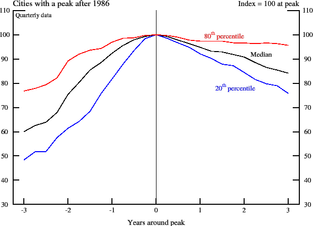
(0,0)(1,0)1
Thus, considering the path of the "median" line, figure 5 reveals that 15 of the 30 large U.S. cities in this broad group have experienced, at some point since 1986, a cumulative, net three-year decline in real land prices of 16 percent or more. This broad set of cities includes Boston (a 24 percent three-year decline through 1991:Q4), Kansas City (30 percent, 1990:Q3), Los Angeles (19 percent, 1992:Q4), New York (28 percent, 1991:Q2), Sacramento (24 percent, 1993:Q4), San Diego (15 percent, 1993:Q1), San Francisco (18 percent, 1992:Q4), St. Louis (26 percent, 1990:Q3) and Washington DC (12 percent, 1992:Q4). Figure 5 does not show the full recovery period for this group of cities, but for the median city (Tampa) it took a full ten years for the real land price index to return to the level at its previous peak. In a number of large cities -- including Los Angeles, Philadelphia, Providence, RI, and Sacramento -- real land prices did not reach their 1990 peaks until 2001 or 2002, well into the current housing boom.
Considering the portion above the median in figure 5, 15 cities in our sample experienced a relatively mild cycle for land prices around 1990 -- their cumulative real decline was generally less than 10 percent and the level of their real land price index had returned to its peak level by the mid-1990s. Indeed, by the time the current housing boom was getting underway toward the end of 1998, their real land price index was considerably above the level at the time of the previous peak. This group includes Charlotte, Detroit, Memphis, Miami, and Minneapolis-St. Paul. With the exception of Charlotte and Memphis -- where land prices have languished in real terms since 1998 -- this group of cities continued to see a rapid expansion of residential land values through 2004.
We note that for most of these cities that experienced a peak in real residential land prices around 1990, the subsequent real depreciation involved a stagnation of land prices in nominal terms that was eroded over time by an increase in core consumer prices. That is, the price index for personal consumption expenditures excluding food and energy items in the National Income and Product Accounts (NIPA) -- which is the index we use to convert nominal values and price indexes into real terms -- rose about 15 percent over three-year periods from 1989 through 1994. This is about the same order of magnitude as our estimate of real peak-to-trough declines in residential land prices for most of these cities, so our data do not suggest widespread, outright nominal declines in land prices. Still, the minority of cities in this group that are estimated to have experienced real land-price declines around 20 percent are also estimated to have seen their nominal land-price indexes fall in the peak-to-trough period.
Midwest cities that have not experienced a previous peak in land prices. According to our estimates, 7 large cities in the midwest have seen a more smooth upward march in real land prices and average land values since 1984, rather than the roller coaster experience of the majority. This group, which includes Chicago, Cincinnati, Indianapolis, and Milwaukee, registered increases in home prices that outpaced construction costs and general price inflation year after year since 1984. In general, for cities in this group, land accounted for a small portion of home value in 1984 -- about 10 percent. By 1998, however, land's share of home value had risen to 30 percent, and, by 2004, the share in these cities had nearly reached 40 percent, not too far below the average across all cities in our sample.
4 Discussion
This paper has introduced methods we developed to build a new database for measuring the evolution of residential land values across large U.S. metropolitan areas since the mid-1980s. We have not yet used the data to estimate models capable of explaining just which economic factors have caused changes in land prices in different areas at different times, but we have documented, for the first time, some key facts that a model would need to explain. In particular, we have shown that, over the past twenty years, residential land has become relatively more expensive in just about every large metro area in the U.S. -- not only in places along the east and west coasts of the country, as some have suspected -- though the pace of appreciation has, of course, varied considerably from region to region. Moreover, we have demonstrated that the current housing boom, which began around the end of 1998, has left its imprint in the form of a rapid appreciation of residential land values just about everywhere. In addition, we have shown that, at some point since 1984, the majority of large U.S. cities have experienced one pronounced price-cycle in which residential land lost value for an extended period of time, usually following several years of particularly rapid appreciation. In real terms, land prices have generally taken several years to go from peak to trough, and the subsequent recovery from these price-declines has generally occurred at a more gradual pace.
To us, the most important implication of our findings is that, looking forward, cycles in land prices will shape the contour of home values to a greater extent than they have in the past -- because in just about every large U.S. metro area land's share of home value is now much higher than it used to be. More specifically, land's greater share of home value could mean faster home-price appreciation, on average, and possibly larger swings in home prices.
To gauge the possible magnitudes, we consider how current land values would translate into future home-price appreciation in cities along the East and West coasts should land prices and construction costs repeat their average performance (in real terms) in recent history. From 1984 through 1998 (ignoring the current boom), these two regions experienced average annual real increases in land prices of 4.2 percent and 4.7 percent, respectively; over the same period, their real construction costs fell by an average of 0.3 percent and 0.8 percent, respectively. In 1984 and 2004, land accounted for 38 percent and 64 percent of home value, on average, in large cities along the East Coast; in cities along the West Coast, land's share was 55 percent in 1984 and 74 percent in 2004. In table E, we plug these values into equation (1) to compute, for each region, the percentage increase in home prices resulting from a repeat-experience of land prices and construction costs from 1984 through 1998. Our calculations imply that simply by taking into account the more expensive land values currently in place we would expect real home prices to accelerate by more than 1 percentage point per year in cities along both coasts. So, even if land prices were to increase from now on at the average pace seen before the current boom, home prices might rise more quickly, on average, than they did before.
| Using Land's Share in 1984: East Coast: |
|
| Using Land's Share in 1984: West Coast: |
|
| Using Land's Share in 2004: East Coast: |
|
| Using Land's Share in 2004: West Coast: |
|
| Acceleration in Home Prices from Higher Land Shares: East Coast: |
|
| Acceleration in Home Prices from Higher Land Shares: West Coast: |
|
The consequences for future home-price volatility could be just as significant because we would expect cycles in home prices to continue to be driven by cycles in real land prices. Again, in our framework, variance of home prices depends on the variances of land prices and construction costs, and the greater current share of home value accounted for by residential land has significantly pushed up the weight on land-price volatility.23 Of course, it is possible that some of the factors driving up residential land prices so significantly over the past twenty years could also work to decrease their volatility, which would offset the simple "accounting effect" of land's greater share of home value. We see this to be an important avenue for future research.